

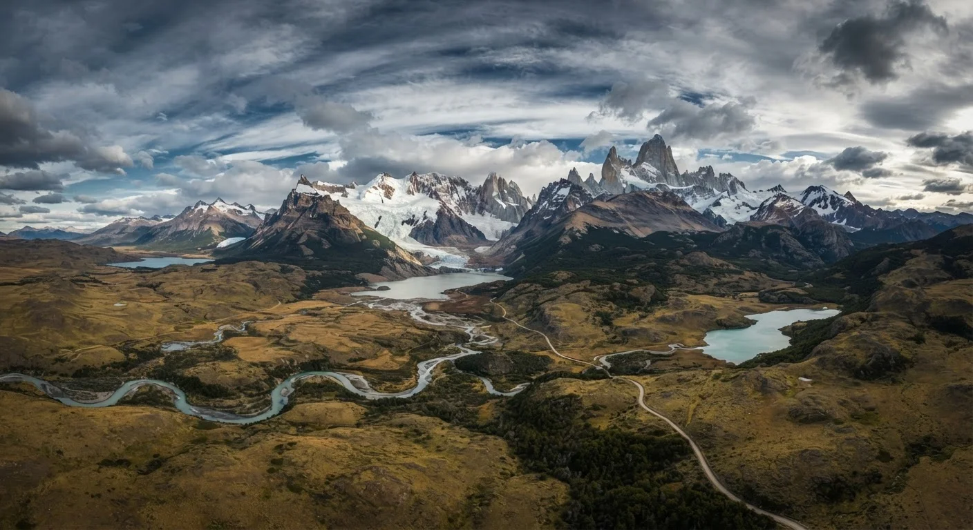
Where Patagonia Actually Begins and Ends
Ask a dozen geographers where Patagonia starts and you may get a dozen slightly different answers. That ambiguity is intentional: Patagonia is a cultural and geographic concept rather than a formally demarcated political territory. By the most widely accepted convention, the region begins south of the Río Colorado in Argentina and south of roughly the same latitude in Chile, placing its northern edge near the 38th to 40th parallel. From there, it extends all the way to the tip of the continent at Tierra del Fuego — the island split between Argentina and Chile and separated from the mainland by the Strait of Magellan.
The Andes serve as the spine dividing the two national sections. To the east lies Argentine Patagonia, dominated by the vast, wind-scoured Patagonian Steppe — one of the largest temperate grassland systems on Earth. To the west sits Chilean Patagonia, compressed between the Andes and the Pacific, a fragmented landscape of fjords, channels, islands, and ancient temperate rainforest. Both sides are enormous: Argentina's Patagonian provinces alone cover more than 300,000 square miles.
Tierra del Fuego: One Island, Two Countries
Tierra del Fuego is frequently listed separately from 'mainland Patagonia,' though it is geographically and culturally continuous with the broader region. The island is divided by a straight-line border: the northern Argentine half is larger and includes the city of Río Grande; the smaller Chilean section includes Puerto Williams, which some geographers and the Chilean government formally designate as the world's southernmost city — a designation disputed with Ushuaia. Travelers crossing between the two sections must clear immigration even though both share the same island.
The Major Landscape Zones Travelers Encounter
Patagonia's terrain sorts into several distinct zones, each with its own character and appeal.
- The Lake District (Norte Patagónico): Straddling the northern Andes across both countries, this zone features deep glacial lakes, volcanic peaks, and forested foothills. The Argentine city of Bariloche anchors the region. It's the most accessible and the greenest corridor of Patagonia.
- The Patagonian Steppe: East of the Andes across Argentina, the steppe is a sweeping plateau of dry grassland and scrub, shaped by relentless westerly winds. Wildlife — guanacos, rheas, Magellanic penguins along the coast — thrives here. Cities like Trelew and Comodoro Rivadavia serve the interior.
- The Southern Icefields: Straddling the Argentine-Chilean border near El Calafate and Puerto Natales, this zone contains the Patagonian Ice Fields — the largest non-polar ice mass on Earth. Glaciers like Perito Moreno are among Patagonia's defining natural spectacles.
- Tierra del Fuego: The southernmost zone, shared by both countries, blends subpolar forest, bogs, and rugged coastline. Ushuaia, Argentina — often marketed as the world's southernmost city — is the main hub.
~400,000 sq mi
Total estimated area of Patagonia
By common geographic convention, Patagonia covers an area larger than Texas and California combined across both Argentina and Chile.
150+ inches
Annual rainfall in wettest Chilean zones
Parts of Chilean Patagonia's Aysén region receive among the highest rainfall totals in South America due to uninterrupted Pacific moisture.
~5 people/sq mi
Average population density (Argentine Patagonia)
Argentine Patagonian provinces are among the least densely populated territories in the Americas, contributing to the region's wilderness character.
Understanding Patagonia's Climate Extremes
Climate is one of the most misunderstood aspects of Patagonia trip planning. The region does not have a single climate — it has several, and they can change dramatically within a short distance.
The Chilean side west of the Andes intercepts moisture-laden Pacific air, producing some of the highest annual rainfall totals on Earth — parts of the Aysén region receive over 150 inches of rain per year, supporting lush Valdivian temperate rainforest. Cross to the Argentine side and the same mountains create a powerful rain shadow: the steppe receives as little as 8 inches annually in places, conditions closer to semi-desert.
Wind is the defining atmospheric force across nearly all of Patagonia. The Roaring Forties and Furious Fifties — bands of latitude notorious among sailors for violent westerlies — sweep through unobstructed. Gusts exceeding 60 mph are not exceptional at Torres del Paine or on the steppe. Layered clothing that handles rapid weather changes is a practical necessity, not a luxury.
Pack for Four Seasons in One Day
Experienced Patagonia travelers recommend layering systems over single heavy garments — conditions can shift from sunshine to horizontal sleet within hours at any time of year. A windproof outer shell is considered essential gear on both sides of the Andes, even in summer. Check current park entry requirements and reservation systems for major parks like Torres del Paine and Los Glaciares well in advance, as quotas apply during peak season.
Key Entry Points and How the Region Connects
Patagonia's sheer size means your entry point shapes your entire experience. Understanding the main gateways helps travelers plan realistic itineraries.
Bariloche, Argentina is the northern entry point, well-connected by air to Buenos Aires and serving as the starting point for the famous Ruta de los Siete Lagos (Route of the Seven Lakes) south toward the Carretera Austral.
Puerto Natales, Chile is the primary gateway to Torres del Paine National Park, accessible by air via Punta Arenas or by overnight ferry from Puerto Montt through the Chilean fjords — one of South America's great scenic journeys.
El Calafate, Argentina sits closest to Los Glaciares National Park and the Perito Moreno Glacier, with a regional airport that makes it reachable without transiting Buenos Aires.
Ushuaia, Argentina anchors the far south and serves as both a destination and the departure point for Antarctic cruise voyages. It is also the southern terminus of Ruta Nacional 3, Argentina's longest highway.
Cross-border travel between Argentine and Chilean Patagonia is common and generally efficient at designated crossings, though travelers should carry documentation and check current border conditions with official sources before traveling. Internal distances are immense — factoring in travel days between zones is essential to a realistic itinerary.
Frequently Asked Questions
Patagonia spans both countries. The Andes form a rough natural boundary, with Argentine Patagonia to the east and Chilean Patagonia to the west. Most itineraries visit both sides, and border crossings are common and generally straightforward.
The most popular window is the Southern Hemisphere summer, roughly November through March, when days are long and trails are accessible. Shoulder months (October and April) offer fewer crowds. Winter brings extreme cold and limited access to many parks, though it suits some specialized travelers.
US citizens do not currently require a visa for tourist visits to Argentina or Chile, but entry requirements can change. Always confirm current rules with official embassy or government sources well before your departure date.
Patagonia covers approximately 400,000 square miles — an area larger than Texas and California combined. Distances between key destinations are substantial, and internal travel by air, ferry, or long-distance bus is usually necessary.
Spanish is the official language on both sides. In tourist hubs like Torres del Paine and Bariloche, English is commonly understood by guides and hospitality staff, though basic Spanish phrases help considerably in smaller towns.
Patagonia's main tourist corridors are generally considered safe for solo travelers, including solo women. The primary risks are environmental — unpredictable weather, remote terrain, and limited emergency services — so thorough trip planning and appropriate gear matter more than crime concerns.
The content on this site is for informational purposes only and is not a substitute for professional advice. Always consult a qualified professional for guidance specific to your situation.